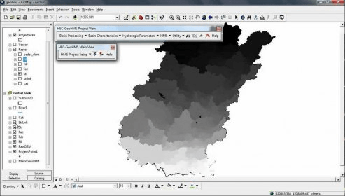
Incorporate the extension into a compatible GIS environment to add a selection of instruments and automated procedures for preparing the native data for import into HEC-HMS. It also features tools for generating GIS data from HMS output. Editing options for numeric modification are available.
HEC-GeoHMS is a free GIS extension that provides the user with a set of procedures, tools, and utilities for the preparation of GIS data for import into HEC-HMS and generation of GIS data from HMS output. The GIS extension has a user friendly interface.

Comments (6)